By Adityan, Editor, Soch Se
The word “Yellowstone” does more than just conjure images of geysers and pristine American wilderness. For many, it evokes a sense of deep, geological dread. Headlines about the “ticking time bomb” beneath the park have become a staple of internet alarmism, painting a picture of a future global winter triggered by a catastrophic supereruption. But what if the sensational headlines are asking the wrong question? What if the real story isn’t if it will blow, but how science is learning to read its pulse with astonishing new clarity?
Recent, groundbreaking Yellowstone supervolcano mapping studies have given us the most detailed look ever into the fiery heart of the beast. But from my perspective as the editor of Soch Se News, this isn’t just another “Yellowstone might blow” panic piece—it’s a powerful story about how new imaging methods are revolutionizing the science of volcanic risk assessment.
This is about converting apocalyptic headlines into measured preparedness. For my readers in India and across the globe, this is a lesson in how cutting-edge science provides the tools to manage, understand, and live with the immense power of our planet. So, let’s peel back the layers of fear and look at what the new science is actually telling us.
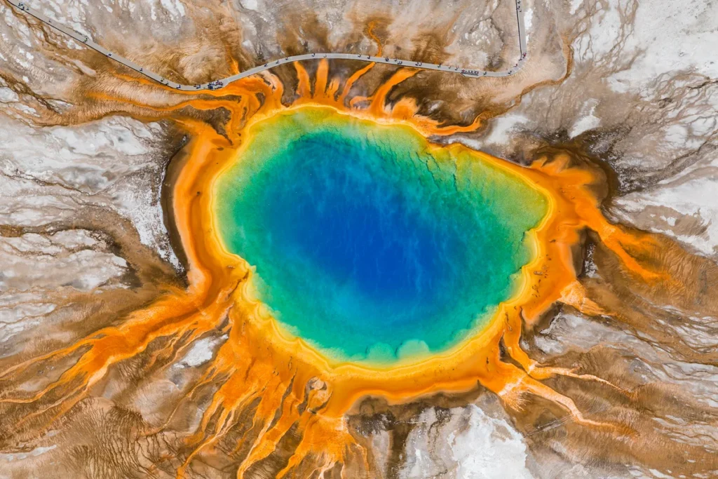
The Sleeping Giant: A Quick Look at Yellowstone’s History
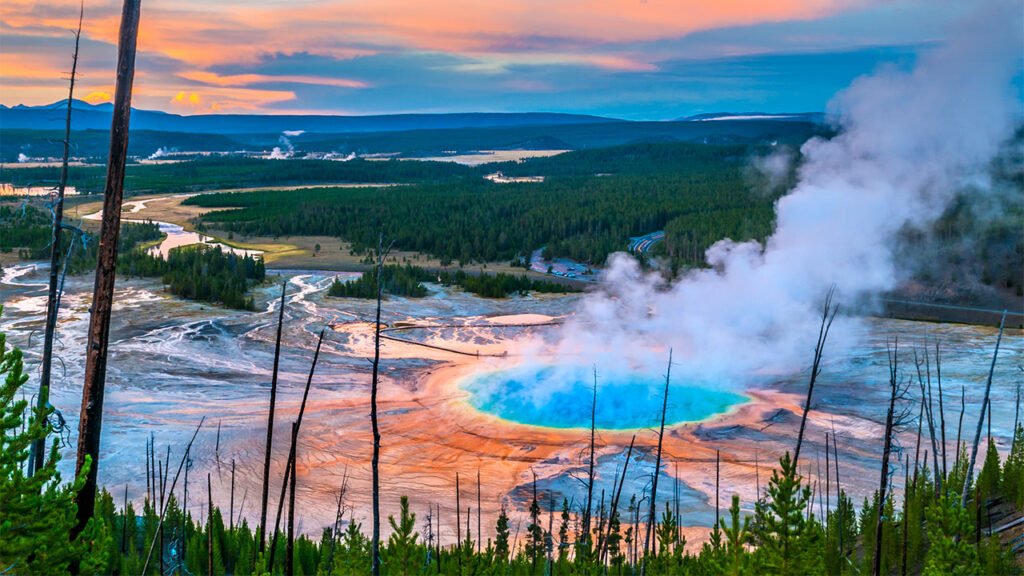
Before we dive into the new data, it’s important to understand the scale of what we’re dealing with. A supervolcano is defined by its ability to produce an eruption of magnitude 8 on the Volcano Explosivity Index (VEI), ejecting more than 1,000 cubic kilometers of material. Yellowstone has had three such colossal eruptions in its past: 2.1 million, 1.3 million, and 640,000 years ago.
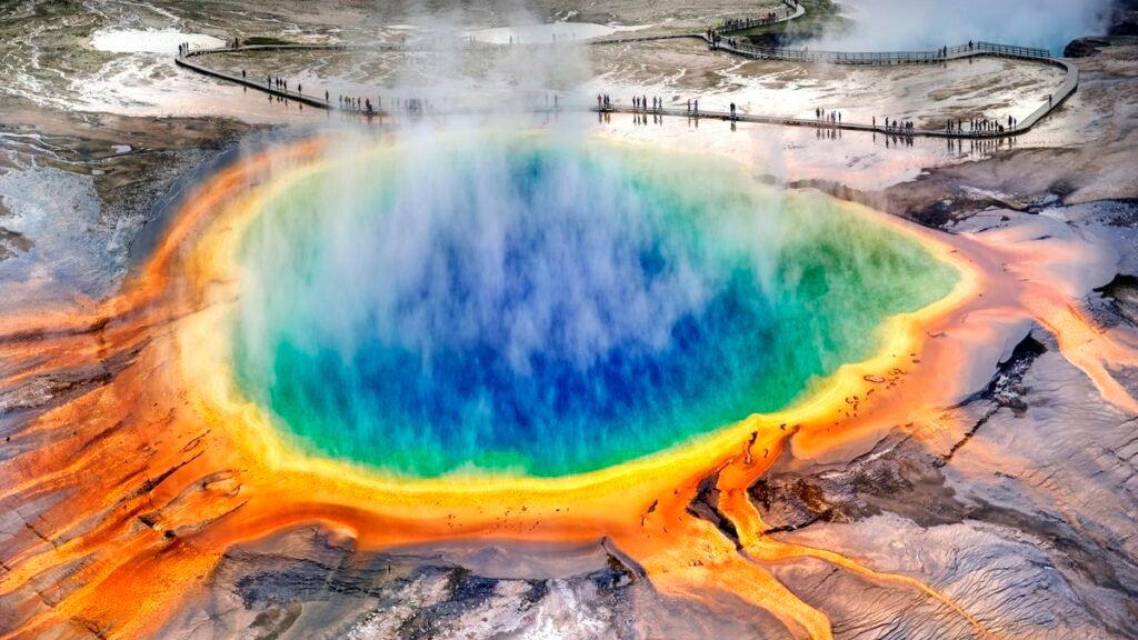
Each of these events dramatically reshaped the North American continent and had global climate consequences. A future VEI-8 eruption would be catastrophic, sending vast ash plumes into the stratosphere, blanketing continents, and potentially triggering a volcanic winter that could last for years, devastating agriculture and ecosystems. It’s this terrifying potential that fuels the headlines. But fear often stems from the unknown. Now, science is beginning to illuminate the darkness beneath Yellowstone with unprecedented precision. Our goal at Soch Se News is to provide clarity; you can learn more about our journalistic standards in our editorial policy.
A New Way of Seeing: The Science Behind the Maps
Until recently, our picture of Yellowstone’s magma system was blurry, like an out-of-focus photograph. But a recent study published in Nature, led by USGS researchers in collaboration with several universities, has brought the image into sharp focus. They used two powerful, complementary techniques:
- Magnetotellurics: This method acts like a geological MRI. It measures shifts in the Earth’s natural electromagnetic field, often triggered by lightning or solar storms. Since molten rock (magma) is more electrically conductive than solid rock, scientists can use these measurements to map out where magma is hiding.
- Controlled-Source Seismic Imaging: Think of this as a high-resolution ultrasound. A large, specialized truck generates tiny, controlled seismic waves. Hundreds of sensors deployed across the park record the echoes of these waves as they bounce off different layers underground. By analyzing these echoes, scientists can create a sharp “CT scan” of the magma system’s structure.
Together, these methods have given us a new, far more nuanced understanding of the plumbing beneath Yellowstone.
In-Depth Analysis: What the New Yellowstone Supervolcano Mapping Really Reveals
This is the core of the story, where we translate the technical data into real-world meaning. What I found during my research is that the new maps don’t signal an impending apocalypse; instead, they provide a more complex and, in many ways, reassuring picture.
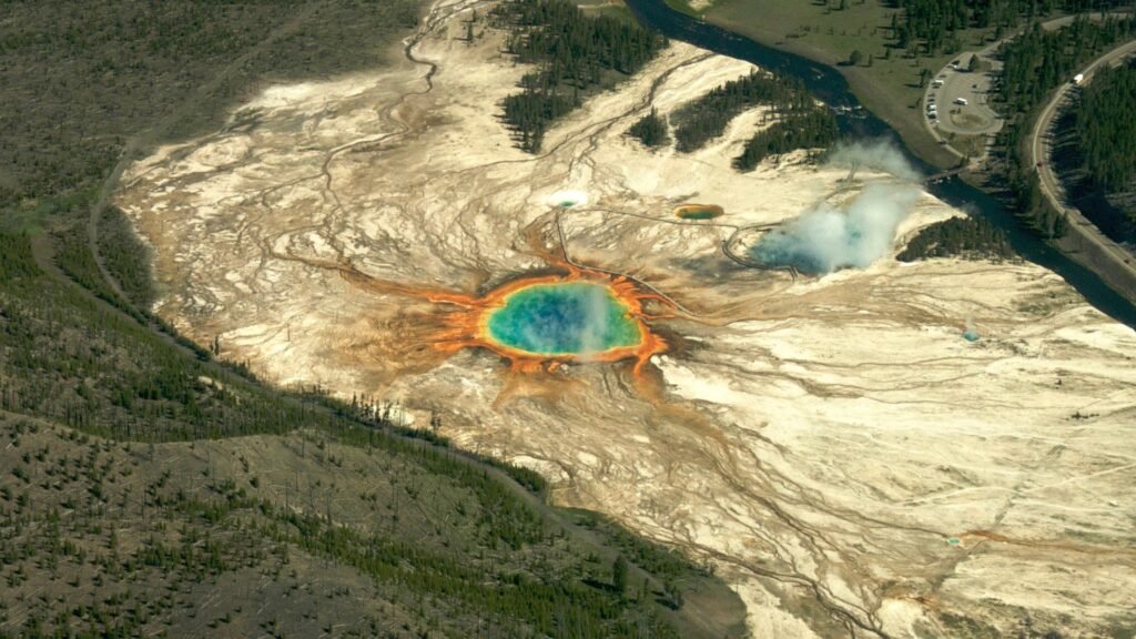
The Discovery of a “Volatile-Rich Cap”
My first key takeaway is this: the new primary fact from controlled-source seismic imaging is the discovery of a sharp, volatile-rich cap approximately 3.8 km beneath Yellowstone’s caldera top. This isn’t just a blob of magma; it’s a specific, shallow layer rich in partial melt and “exsolved volatiles”—gases and fluids like water and carbon dioxide that have separated from the molten rock. From my perspective, this changes the entire hazard framing. This cap appears to be “breathing,” steadily venting these gases through porous pathways up to the famous hydrothermal system (the geysers and hot springs). This steady release of pressure acts like a safety valve, making a sudden, catastrophic buildup less likely.
Four Distinct Reservoirs, Not One Giant Blob
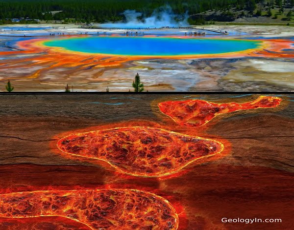
The second primary fact, revealed by independent magnetotelluric imaging, is the presence of four distinct magma reservoirs between approximately 4 and 11 km deep. These are not one single, massive pool of molten rock ready to erupt. They are separate pockets of rhyolitic magma—a type of magma rich in silica that is indeed capable of explosive behavior. One of these reservoirs contains a volume of magma comparable to the Mesa Falls eruption 1.3 million years ago. The key word here, however, is potential. Their existence is a given, but their ability to erupt depends on other factors.
The Wild Card: Basaltic Heat and Connectivity
This leads to my third key point, an interpretation based on expert opinion: while the current state is stable, the system is dynamic. The real “wild card” that can link these reservoirs over time is heat from deeper basaltic intrusions. Deeper, hotter basaltic magma acts as the engine of the system, releasing immense heat that can melt more of the overlying rhyolitic rock. According to volcanologist Larry Mastin of the USGS, while “current melt fractions are too low to suggest imminent eruption,” he warns that “things can change in decades, not just millennia.” This means that while there’s no immediate threat, the connectivity between these reservoirs is the single most important variable to monitor.
Reframing the Real Risk: Hydrothermal Explosions, Not Global Winter
So, what is the most likely threat? My analysis of the practical implications is clear: the most plausible near-term hazards from Yellowstone are localized hydrothermal explosions, small magmatic intrusions, or periods of volcanic unrest (like ground swelling and earthquake swarms), not an immediate global supereruption. The volatile-rich cap, while acting as a safety valve, also poses its own hazard. If its pathways were to become blocked, pressure could build up and cause a powerful, but localized, steam-driven explosion. This is a serious hazard for the immediate park area but does not pose a global threat.
The Indian Parallel: From Panic to Preparedness
This brings me to my final, and perhaps most important, public-safety anchor: this entire scientific endeavor is a powerful lesson for us in India. We have our own high-risk zones, from the seismic activity in the Himalayas to our long coastline vulnerable to tsunamis. The response to the Yellowstone risk—a massive, multi-institutional collaboration using data fusion and continuous monitoring—is a model India can and should learn from.
Reliable early warning is feasible because large-scale magma reorganization produces detectable precursors like ground deformation and seismic swarms. The USGS has made it clear that a large eruption would likely give weeks, if not months, of clear warning signals. This knowledge is power. It allows us to shift the public narrative from sensationalism and fear towards a focus on robust preparedness policies, monitoring investment, and clear public communication. It’s a mindset that is crucial for our own disaster management authorities. If you have questions about our approach, you can always contact us.
Conclusion:
So, is the Yellowstone supervolcano about to bring about a global winter? The latest science says no. The new Yellowstone supervolcano mapping has not revealed a monster poised to strike, but rather a complex, breathing geological system that we are finally beginning to understand with incredible detail.
My final verdict is this: the story of Yellowstone in 2025 is not one of impending doom, but one of scientific triumph. It’s a testament to how technology can replace fear with knowledge. By understanding the intricate plumbing of the volcano, scientists can monitor it more effectively than ever before, focusing on the real variables that matter—melt fraction, gas pressure, and connectivity.
This is a story of science turning a terrifying symbol of catastrophe into a manageable, albeit immense, natural hazard. And for the rest of the world, it is a blueprint for how to live on a dynamic and powerful planet. We must, of course, provide a disclaimer that all geological forecasting is based on current data and can change. To learn more about our mission, please visit our about us page.
Frequently Asked Questions (FAQ)
1. Does the new mapping mean a Yellowstone supereruption is more or less likely?
The new mapping does not suggest an imminent supereruption. By revealing that the magma system is made of distinct, patchy reservoirs and that the shallowest part is steadily venting gas, the findings suggest the immediate risk of a massive eruption is low. However, it refines what scientists need to monitor for long-term changes.
2. What is the most immediate danger from Yellowstone?
Based on current data, the most plausible near-term hazards are smaller-scale events like hydrothermal explosions (steam-driven blasts) or localized volcanic unrest (earthquake swarms and ground swelling), which would primarily affect the area within and immediately around the park.
3. How much warning would we have before a large eruption?
The USGS states that a large magmatic eruption would be preceded by weeks to months of intense and obvious precursory activity. This would include significant ground deformation, a dramatic increase in the frequency and intensity of earthquakes, and changes in gas and thermal emissions, all of which are continuously monitored.